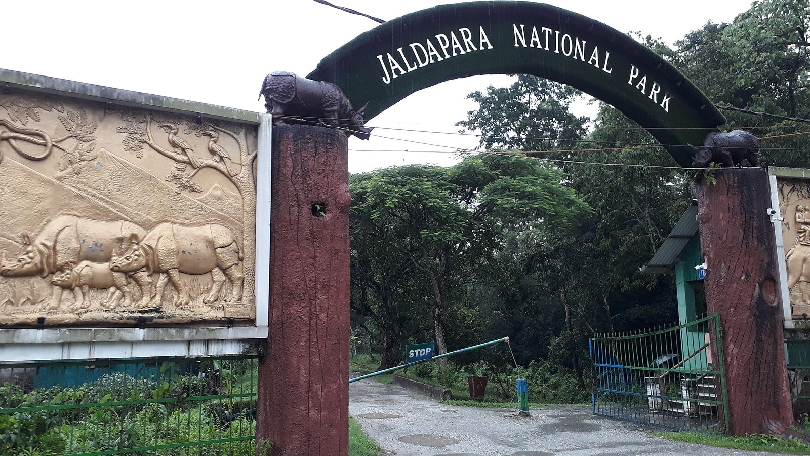
Jaldapara National park, west-bengal
Introduction
Jaldapara National Park is a 216.5 km² grassland‑riverine ecosystem in the Himalayan foothills of West Bengal, renowned for India’s largest state population of the greater one‑horned rhinoceros outside Assam and one of the country’s last breeding sites for the Bengal florican. Centered on the Torsa River’s alluvial plains, the park’s low elevation and seasonal flooding create tall‑grass mosaics, moist deciduous patches, and sandbar wetlands that support megaherbivores, elephants, and over two hundred bird species. Designed for students and educators, this guide explains Jaldapara’s geography, habitats, flora, fauna, conservation history, community linkages, and current research, with a concise, secondary section on how to visit responsibly.
Essential Facts About Jaldapara National Park
Key facts
| Item | Details |
|---|---|
| Location | Alipurduar district, northern West Bengal; Himalayan foothill plains on the Torsa River |
| Coordinates | ~26.69° N, 89.28° E |
| Area | 216.5 km² |
| Elevation | ~61 m above sea level (flat alluvial terrace) |
| Status | Wildlife Sanctuary (1941) → National Park (2012) |
| Core habitats | Saccharum tall grassland, moist deciduous forest patches, seasonally flooded riverbanks |
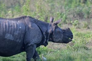
| Flagship fauna | Greater one‑horned rhinoceros, Asian elephant, Bengal florican, hog deer, leopard |
| Designations | Part of Eastern Dooars Important Bird Area (IBA); within Dooars Elephant Reserve corridors |
Geography, hydrology, and climate
-
Sits on the Eastern Himalayan foothills; terrain is a flood‑built terrace dissected by the Torsa and tributaries (e.g., Malangi, Hollong, Sissamara).
-
Seasonal monsoon floods shape sandbars, swamps, and oxbow wetlands; dry-season grass regrowth supports herbivores and florican displays.
-
Climate is humid subtropical to monsoonal; heavy rains sustain rapid grass turnover and rich edge habitats between riverine forest and grassland.
Habitats and ecological processes
-
Tall Saccharum and Phragmites grasses dominate open plains; moist deciduous islands feature Syzygium, Lagerstroemia, and Terminalia.
-
Controlled patch‑burning and mechanical mowing prevent grassland from converting to woodland and keep grass height suitable for floricans and grazing megafauna.
-
Flood pulses replenish soil nutrients; riparian corridors enable fish dispersal and amphibian breeding.
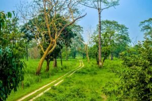
Image Source: Abhishek21051989, CC BY-SA 4.0, via Wikimedia Commons
Flora: structure, diversity, and key plants
-
Canopy and sub‑canopy include Syzygium cumini, Lagerstroemia parviflora, Trewia nudiflora; understory grasses and sedges drive herbivore biomass.
-
Seabuckthorn is absent here (cold‑desert species); instead, riverine associates, cane, and climbers occupy edges and backswamps.
-
Students should learn to distinguish grass growth stages (post‑monsoon vs. late dry season) and link them to herbivore foraging patterns.
Fauna: mammals, birds, herpetofauna, fish
Mammals
-
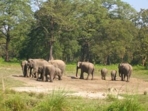
Greater one‑horned rhinoceros (state’s largest population), Asian elephant herds, leopard, sambar, hog deer, barking deer, wild boar, and gaur.
-
Landscape connectivity via Dooars corridors supports seasonal elephant movement and genetic exchange.
Birds
-
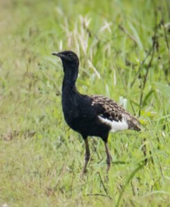
240+ species recorded; Bengal florican (Critically Endangered) breeds in short‑grass mosaics; raptors like crested and Pallas’s fish eagles patrol riverine edges.
-
Watchtowers near grass‑ridge lines enable low‑disturbance observation and standardized student surveys (point counts and scan sampling).
Herpetofauna and fish
-
Pythons, monitor lizards, cobras, kraits, geckos; freshwater turtles use slow backwaters.
-
Recent ichthyofaunal updates from the Torsa have added new cyprinid records, illustrating the park’s riverine diversity.
Human dimensions: history, communities, and livelihoods
-
The landscape intersects ancestral homelands of the Toto and Mech (Bodo) peoples; the area was colloquially called “Totopara.”
-
Non‑timber forest products (NTFPs) such as edible mushrooms, medicinal plants, and thatch grasses contribute significant household cash income in fringe villages.
-
Community‑based tourism now complements incomes, incentivizing anti‑poaching vigilance and fuelwood reduction via biogas/LPG programs.
Conservation history and management
-
1941: Sanctuary notified to protect rhinos and associated fauna; elevated to National Park in 2014.
-
Anti‑poaching squads, rhino translocations (historically from Assam), and corridor protection under the Dooars Elephant Reserve support population recovery.
-
Annual patch‑burns and mowing maintain grass height (<1 m) for florican displays and rhino forage; solar fencing and rapid‑response teams reduce human–elephant conflict.
Table: Challenges and responses
| Challenge | Response & outcome |
|---|---|
| Rhino poaching (late 1960s–early 1970s) | Armed protection and strategic translocations stabilized growth trends |
| Grassland succession | Patch‑burning & mowing retain early‑successional structure |
| Human–elephant conflict | Solar fences and rapid response teams reduce crop raids |
| Fuelwood pressure | Biogas/LPG adoption cuts daily fuelwood trips in pilot hamlets |
Current research themes (2015–2025)
-
Avifaunal guilds: Bengal florican occupancy vs. grass height thresholds (<1 m).
-
Population genetics: Small, isolated rhino populations risk genetic erosion; supplementation scenarios emphasize cross‑site genetic rescue.
-
River ecology: New fish records from the Torsa refine species lists and prioritize riparian protection.
-
LULC and corridors: Geoinformatics studies track fragmentation between Jaldapara–Buxa complexes to optimize mitigation.
Education use: fieldwork modules and classroom prompts
Student field modules (half‑ to multi‑day)
-
Grass height stratification and florican display counts (design a sampling grid).
-
Dung transects and pellet group counts for ungulate indices (hog deer vs. sambar).
-
Riparian macroinvertebrate biotic index as a proxy for water quality.
-
Human–wildlife coexistence interviews: fuel transitions, crop‑raid diaries, mitigation mapping.
Classroom prompts
-
Debate: “Are controlled burns essential to grassland conservation in the Dooars?”
-
Data story: Plot hypothetical rhino demographics vs. anti‑poaching effort.
-
Policy memo: Corridors vs. fencing—trade‑offs for elephants and people.
Visitor snapshot and ethics
-
Access season: Typically mid‑September to mid‑June; monsoon closure in between.
-
Safaris: Jeep (≈2 h) and limited dawn elephant rides; advance e‑permits required; adhere to viewing distances and noise discipline.
-
Stay: Hollong Forest Bungalow (inside core) and nature camps near Madarihat.
-
Always confirm current fees, timings, and booking rules with the West Bengal Forest Department.
| Attribute | 2025 Info |
|---|---|
| Gate hours | 06 :00 – 17 :00; closed 16 Jun – 14 Sep monsoon |
| Safaris | Jeep (≈ ₹2,000/vehicle) & dawn elephant rides (₹1,100 pp); e-permit required |
| Eco-stay | Hollong Forest Bungalow (8 rooms, 90-day advance); Madarihat nature camps |
How to reach
-
Rail: Madarihat (≈7 km) on the Siliguri–Alipurduar line; Hasimara 13 km; Falakata 25 km.
-
Road: NH‑31 buses from Siliguri (≈125 km/3 h) and Cooch Behar (≈60 km); alight at Madarihat.
-
Air: Bagdogra (≈150 km), Cooch Behar (≈65 km; seasonal).
-
From Kolkata: Overnight trains (e.g., Kanchankanya Express) to Madarihat; or fly CCU→IXB and drive via Siliguri–NH‑31; overnight WBTDC AC coach also operates seasonally.
FAQ
-
Q: Where is Jaldapara National Park located?
A: In Alipurduar district, northern West Bengal, on the Himalayan foothill plains along the Torsa River. -
Q: Why is Jaldapara famous?
A: For its large population of greater one‑horned rhinoceroses and as a rare Indian breeding site of the Bengal florican. -
Q: What habitats does it protect?
A: Tall Saccharum grasslands, moist deciduous patches, and seasonally flooded riverbanks and wetlands. -
Q: When is the best time for field studies?
A: Post‑monsoon to winter (October–March) for bird and florican surveys; pre‑monsoon for grass structure sampling.
Jaldapara National Park shows how floodplain grasslands—often overlooked in favor of forests—can anchor megafauna, rare birds, and fishing livelihoods when managed as living, changing systems. For students, it is a real‑world lab in which hydrology shapes habitat, cutting‑edge management (from patch burns to corridor planning) supports rhinos and elephants, and village energy transitions reduce pressure on woodlands. For educators, it offers repeatable, low‑impact field modules that build data literacy and critical thinking about coexistence. Visiting may be secondary, yet understanding Jaldapara’s ecological logic is primary: a tall‑grass mosaic, tuned by water and fire, sustaining biodiversity and people together.
Hemis National Park : The Largest National Park In India
Gir National Park: Glorious History & Exciting Tourism (2025)
Kaziranga National Park | Explore Assam’s Incredible Wildlife | 2025
Sanjay Gandhi National Park – History, Overview & Highlights
National Parks in India, 2025 – Complete List of 107 Beautiful Parks